The Blue Gate: Difference between revisions
From ARC Raiders Wiki
More actions
Content deleted Content added
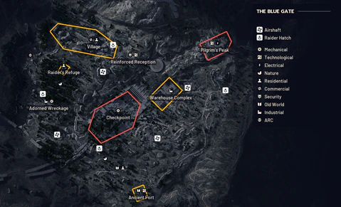
added an ugly but only screenshot for now avalible for showing blue gate map |
No edit summary |
||
| Line 8: | Line 8: | ||
|difNR= Unknown |
|difNR= Unknown |
||
}} |
}} |
||
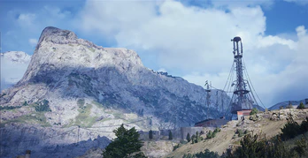
'''The Blue Gate''' is a [[Maps|map]] located higher up in the mountains featuring open areas, small towns, tunnels, and underground complexes to name a few. |
|||
More info coming soon |
|||
<blockquote>The idea for Blue Gate began with early concept art exploring how the vast infrastructure of the Exodus era was constructed to support the major facilities scattered across the Rust Belt. Our goal was to design a map located on the region’s edge, built into a mountainside, and serving as a kind of border to the lands beyond. To contrast the heavy, brutalist concrete aesthetic of the tunnel gate, we chose a lush, green biome that stands apart from our other maps, which are set in drier climates.</blockquote> |
|||
==Maps== |
|||
[[File:Blue Gate Map.png| |
[[File:Blue Gate Map.png|480px]] |
||
[[Category:Maps]] |
[[Category:Maps]] |
||
Revision as of 23:19, 29 October 2025
This article is a stub. This article needs some work! You can help us out by expanding it
 | |
| The Blue Gate | |
|---|---|
| Once a steadyfast symbol of defiant connection, the Blue Gate now serves as a daunting entryway into the perilous mountain ranges. The surrounding valley bears scars both new and old. | |
| Difficulty | |
| Normal Variant | 4/5 |
| Unknown | |
| Unknown | |
The Blue Gate is a map located higher up in the mountains featuring open areas, small towns, tunnels, and underground complexes to name a few.
